Visible settings of Designated Landscapes and Key Views
Many parts of Wales fall within the Zone of Theoretical Visibility (ZTV) of a Designated Landscape.
View a map showing the combined ZTV from all Designated Landscapes, mapped up to 35km away.
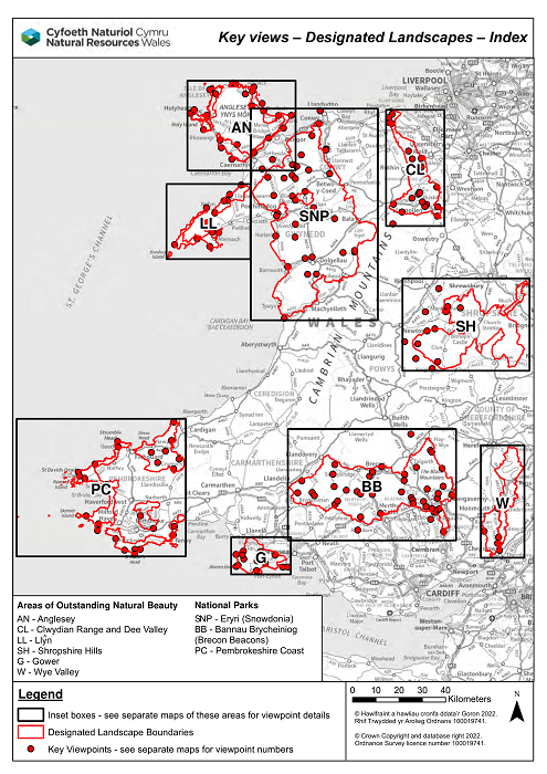
Anglesey
Bannau Brycheiniog National Park (Brecon Beacons)
Clwydian Range and Dee Valley AONB
Eryri National Park (Snowdonia)
Gower AONB
Llŷn AONB
Pembrokeshire Coast National Park
Shropshire Hills AONB
Wye Valley AONB
Notes:
- For visible areas, maps show a Zone of Theoretical Visibility (ZTV).
- For areas not visible, maps show the Height of an Object before it becomes Visible (HOBV).
- We calculated the data using a 30 metre Digital Terrain Model (DTM). Observer points were 1.5m above ground level. The calculations take into account the Earth’s curvature.
- For Designated Landscapes, we used thousands of observer points scattered across the area.
- For key views we used a cluster of 9 points. Use the key views links to find out more.
- We only calculated data as far as 35km from an observer point. More distant views may also be possible.
- User guidance explains and illustrates what the data shows
- A detailed technical report shows how the data was calculated
- You can also view the ZTV for each LANDMAP Visual and Sensory area